
 Vítkovce
Harhaj
Blatná Polianka
Orlov
Bzenov
Chrastné
Dolná Poruba
Kvačany
Kožuchovce
Vítkovce
Harhaj
Blatná Polianka
Orlov
Bzenov
Chrastné
Dolná Poruba
Kvačany
Kožuchovce
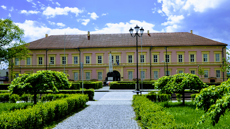
Gemersko-malohontské múzeum on the map, Rimavská Sobota, Slovakia
Photo
Where is located Gemersko-malohontské múzeum
Gemersko-malohontské múzeum — local attraction, which is located at Nám. M. Tompu 14/5, 979 01 Rimavská Sobota, Slovakia and belongs to the category — museum. Average visitor rating for this place — 4.6 (according to 80 ratings, information from open sources and relevant for 2022).
Exact location — Gemersko-malohontské múzeum, marked on the map with a red marker.
You can get directions to Gemersko-malohontské múzeum on the map from your location.
What else is interesting in Rimavská Sobota? You can see all the sights if you go to the city page.
Coordinates
Gemersko-malohontské múzeum, Slovakia coordinates in decimal format: latitude — 48.384390215220016, longitude — 20.021454725207082. When converted to degrees, minutes, seconds Gemersko-malohontské múzeum has the following coordinates: 48°23′3.8 north latitude and 20°1′17.24 east longitude.
Nearby cities
The largest cities that are located nearby:
- Miskolc
 (Hungary) — 63 km
 - Košice — 98 km
- Budapest (Hungary) — 122 km
- Nyíregyháza (Hungary) — 135 km
- Debrecen (Hungary) — 153 km
- Kecskemét (Hungary) — 166 km
- Uzhhorod
 (Ukraine) — 168 km
 - Bielsko-Biala
 (Poland) — 173 km
 - Székesfehérvár (Hungary) — 179 km
- Kraków (Poland) — 186 km
- Győr (Hungary) — 192 km
- Tarnow (Poland) — 193 km
- Ostrava
 (Czech Republic) — 202 km
 - Oradea
 (Romania) — 204 km
 - Rybnik (Poland) — 217 km
- Katowice (Poland) — 220 km
- Sosnowiec (Poland) — 220 km
- Dabrowa Gornicza (Poland) — 222 km
- Ruda Slaska (Poland) — 223 km
Distance to the capital
Distance to the capital (Bratislava) is about — 217 km.