
 Vítkovce
Harhaj
Blatná Polianka
Orlov
Bzenov
Chrastné
Dolná Poruba
Kvačany
Kožuchovce
Vítkovce
Harhaj
Blatná Polianka
Orlov
Bzenov
Chrastné
Dolná Poruba
Kvačany
Kožuchovce
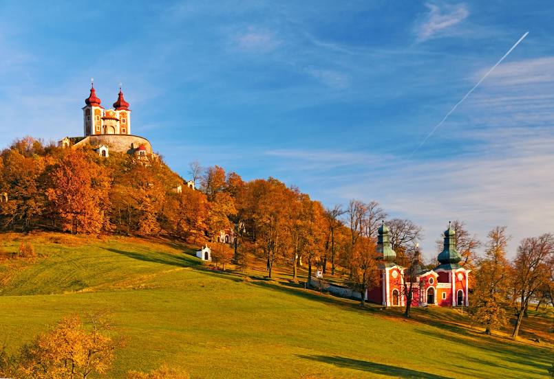
Banská Štiavnica Calvary on the map, Banská Štiavnica, Slovakia
Photo
Where is located Banská Štiavnica Calvary
Banská Štiavnica Calvary — local attraction, which is located at Pod Kalváriou, 969 01 Banská Štiavnica, Slovakia and belongs to the category — historical landmark. Average visitor rating for this place — 4.8 (according to 2526 ratings, information from open sources and relevant for 2022).
Exact location — Banská Štiavnica Calvary, marked on the map with a red marker.
You can get directions to Banská Štiavnica Calvary on the map from your location.
What else is interesting in Banská Štiavnica? You can see all the sights if you go to the city page.
Coordinates
Banská Štiavnica Calvary, Slovakia coordinates in decimal format: latitude — 48.44316304658421, longitude — 18.903293148289897. When converted to degrees, minutes, seconds Banská Štiavnica Calvary has the following coordinates: 48°26′35.39 north latitude and 18°54′11.86 east longitude.
Nearby cities
The largest cities that are located nearby:
- Budapest
 (Hungary) — 107 km
 - Győr (Hungary) — 126 km
- Miskolc (Hungary) — 144 km
- Székesfehérvár (Hungary) — 145 km
- Bielsko-Biala
 (Poland) — 151 km
 - Ostrava
 (Czech Republic) — 157 km
 - Olomouc (Czech Republic) — 172 km
- Košice — 175 km
- Kecskemét (Hungary) — 183 km
- Rybnik (Poland) — 183 km
- Brno (Czech Republic) — 184 km
- Vienna
 (Austria) — 188 km
 - Kraków (Poland) — 193 km
- Ruda Slaska (Poland) — 199 km
- Katowice (Poland) — 200 km
- Sosnowiec (Poland) — 203 km
- Chorzow (Poland) — 203 km
- Gliwice (Poland) — 204 km
- Zabrze (Poland) — 206 km
Distance to the capital
Distance to the capital (Bratislava) is about — 137 km.