
 Vítkovce
Harhaj
Blatná Polianka
Orlov
Bzenov
Chrastné
Dolná Poruba
Kvačany
Kožuchovce
Vítkovce
Harhaj
Blatná Polianka
Orlov
Bzenov
Chrastné
Dolná Poruba
Kvačany
Kožuchovce
Ski Fun Hruštín on the map, Dolný Kubín, Slovakia
Photo
Where is located Ski Fun Hruštín
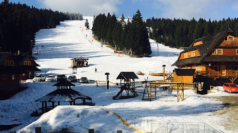
Ski Fun Hruštín — local attraction, which is located at 2283, 029 52 Hruštín, Slovakia and belongs to the category — ski resort. Average visitor rating for this place — 4.6 (according to 353 ratings, information from open sources and relevant for 2022).
Exact location — Ski Fun Hruštín, marked on the map with a red marker.
You can get directions to Ski Fun Hruštín on the map from your location.
What else is interesting in Dolný Kubín? You can see all the sights if you go to the city page.
Coordinates
Ski Fun Hruštín, Slovakia coordinates in decimal format: latitude — 49.29614689372603, longitude — 19.25899842523931. When converted to degrees, minutes, seconds Ski Fun Hruštín has the following coordinates: 49°17′46.13 north latitude and 19°15′32.39 east longitude.
Nearby cities
The largest cities that are located nearby:
- Bielsko-Biala
 (Poland) — 70 km
 - Ostrava
 (Czech Republic) — 100 km
 - Kraków (Poland) — 105 km
- Rybnik (Poland) — 112 km
- Katowice (Poland) — 118 km
- Ruda Slaska (Poland) — 120 km
- Sosnowiec (Poland) — 120 km
- Chorzow (Poland) — 123 km
- Dabrowa Gornicza (Poland) — 123 km
- Gliwice (Poland) — 128 km
- Zabrze (Poland) — 129 km
- Bytom (Poland) — 129 km
- Tarnow (Poland) — 149 km
- Olomouc (Czech Republic) — 153 km
- Košice — 153 km
- Miskolc
 (Hungary) — 164 km
 - Częstochowa (Poland) — 178 km
- Opole (Poland) — 189 km
- Budapest (Hungary) — 190 km
Distance to the capital
Distance to the capital (Bratislava) is about — 203 km.