
 Vítkovce
Harhaj
Blatná Polianka
Orlov
Bzenov
Chrastné
Dolná Poruba
Kvačany
Kožuchovce
Vítkovce
Harhaj
Blatná Polianka
Orlov
Bzenov
Chrastné
Dolná Poruba
Kvačany
Kožuchovce
Michael's Gate on the map, Bratislava, Slovakia
Photo
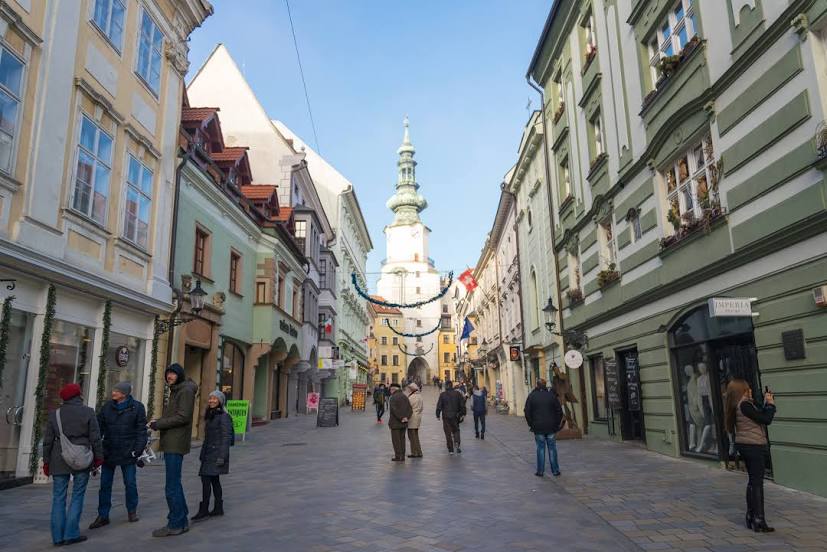
Where is located Michael's Gate
Michael's Gate — local attraction, which is located at Michalská ulica 22 806/24, 811 03 Staré Mesto, Slovakia and belongs to the category — building. Average visitor rating for this place — 4.5 (according to 9718 ratings, information from open sources and relevant for 2022).
Exact location — Michael's Gate, marked on the map with a red marker.
You can get directions to Michael's Gate on the map from your location.
What else is interesting in Bratislava? You can see all the sights if you go to the city page.
Coordinates
Michael's Gate, Slovakia coordinates in decimal format: latitude — 48.145127864751444, longitude — 17.10670462519871. When converted to degrees, minutes, seconds Michael's Gate has the following coordinates: 48°8′42.46 north latitude and 17°6′24.14 east longitude.
Nearby cities
The largest cities that are located nearby:
- Vienna
 (Austria) — 54 km
 - Győr
 (Hungary) — 65 km
 - Brno
 (Czech Republic) — 121 km
 - Székesfehérvár (Hungary) — 145 km
- Olomouc (Czech Republic) — 160 km
- Budapest (Hungary) — 161 km
- Graz (Austria) — 173 km
- Ostrava (Czech Republic) — 203 km
- Linz (Austria) — 208 km
- Bielsko-Biala
 (Poland) — 232 km
 - Kecskemét (Hungary) — 239 km
- Rybnik (Poland) — 239 km
- Pécs (Hungary) — 245 km
- Gliwice (Poland) — 262 km
- Ruda Slaska (Poland) — 264 km
- Zabrze (Poland) — 268 km
- Miskolc (Hungary) — 270 km
- Katowice (Poland) — 271 km
- Chorzow (Poland) — 271 km