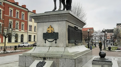
 Gryazi
  Ola
Ola  Pevek
Pevek  Kondratovo
  Asino
Asino  Kirensk
  Nikita
  Kolbasa
  Sharya
  Buguruslan
  Kulebaki
  Igarka
  Mrakovo
  Zelenodolsk
  Perevoz
  Bezenchuk
  Bolshoy Istok
  Starominskaya
  Starodub
Chernyakhovsk on the map, Russian Federation
Where is located Chernyakhovsk
Exact location — Chernyakhovsk, Chernyakhovsky District, Kaliningrad Oblast, Russia, marked on the map with a red marker.
Coordinates
Chernyakhovsk, Russian Federation coordinates in decimal format: latitude — 54.6312721, longitude — 21.8311353. When converted to degrees, minutes, seconds Chernyakhovsk has the following coordinates: 54°37′52.58 north latitude and 21°49′52.09 east longitude.
Population
Chernyakhovsk, Chernyakhovsky District, Kaliningrad Oblast, Russia, according to our data the population is — 45,188 residents, which is about 0% of the total population of the country (Russian Federation).
Comparison of the population on the graph:
Exact time
Time zone for this location Chernyakhovsk — UTC +2 Europe/Kaliningrad. Exact time — wednesday, 12 december 2024 year, 17 h. 57 minutes.
Sunrise and sunset
Chernyakhovsk, sunrise and sunset data for a date — wednesday 4.12.2024.
| Sunrise | Sunset | Day (duration) |
|---|---|---|
| 08:41 +1 minute | 16:04 -0 minutes | 7 h. 24 minutes. -1 minute |
You can control the scale of the map using the auxiliary tools to find out exactly where it is located Chernyakhovsk. When you change the scale of the map, the width of the ruler also changes (in kilometers and miles).
Nearby cities
The largest cities that are located nearby:
- Kaliningrad — 84 km
- Klaipėda
(Lithuania) — 126 km
- Olsztyn
(Poland) — 129 km
- Kaunas
(Lithuania) — 135 km
- Elblag
(Poland) — 166 km
- Šiauliai
(Lithuania) — 171 km
- Bialystok
(Poland) — 188 km
- Panevėžys
(Lithuania) — 199 km
- Gdańsk
(Poland) — 208 km
- Gdynia
(Poland) — 212 km
- Vilnius
(Lithuania) — 220 km
- Plock
(Poland) — 271 km
- Warsaw
(Poland) — 271 km
- Torun
(Poland) — 280 km
- Wloclawek
(Poland) — 287 km
- Rīga
(Latvia) — 291 km
- Bydgoszcz
(Poland) — 304 km
- Brest
(Belarus) — 309 km
- Daugavpils
(Latvia) — 323 km
Distance to neighboring capitals:
- Vilnius
(Lithuania) — 222 km
- Warsaw
(Poland) — 273 km
- Rīga
(Latvia) — 294 km
- Minsk
(Belarus) — 381 km
- Tallinn
(Estonia) — 563 km
- Stockholm
(Sweden) — 569 km
- Mariehamn
(Åland Islands) — 618 km
- Helsinki
(Finland) — 644 km
- Prague
(Czech Republic) — 713 km
- Kyiv
(Ukraine) — 749 km
- Oslo
(Norway) — 886 km
- Bucharest
(Romania) — 1176 km
- Tbilisi
(Georgia) — 2209 km
- Yerevan
(Armenia) — 2325 km
- Tehran
(Iran) — 3092 km
- Astana
(Kazakhstan) — 3283 km
- Khan-Uul
(Mongolian) — 5595 km
- Kathmandu
(Nepal) — 5848 km
- Beijing
(China) — 6764 km
- Pyongyang
(North Korea) — 7350 km
- Seoul
(South Korea) — 7545 km
- Hanoi
(Vietnam) — 7738 km
Attractions
Distance to the capital
Distance to the capital (Moscow) is about — 1008 km.


