 Puerto de la Duquesa
  La Serna de Iguña
  Pumalverde
  Puentenansa
  La Iglesia
  Casar de Periedo
  Fuengirola
  Renedo de Piélagos
  Villabanez
Periurbano La Corchuela Park on the map, Los Palacios y Villafranca, Spain
Photo

Where is located Periurbano La Corchuela Park
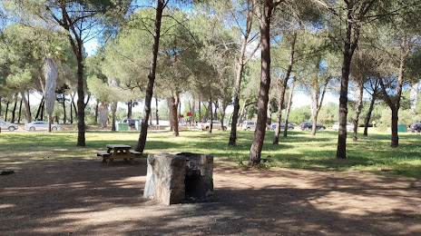
Periurbano La Corchuela Park — local attraction, which is located at Unnamed Road, 41700, Dos Hermanas, Sevilla, Spain and belongs to the category — park. Average visitor rating for this place — 4.3 (according to 356 ratings, information from open sources and relevant for 2022).
Exact location — Periurbano La Corchuela Park, marked on the map with a red marker.
You can get directions to Periurbano La Corchuela Park on the map from your location.
What else is interesting in Los Palacios y Villafranca? You can see all the sights if you go to the city page.
Coordinates
Periurbano La Corchuela Park, Spain coordinates in decimal format: latitude — 37.23336674060259, longitude — -5.981560175148433. When converted to degrees, minutes, seconds Periurbano La Corchuela Park has the following coordinates: 37°14′0.12 north latitude and -5°58′53.62 east longitude.
Nearby cities
The largest cities that are located nearby:
- Dos Hermanas — 14 km
- Jerez — 55 km
- Cádiz — 77 km
- Huelva — 90 km
- Marbella — 117 km
- Algeciras — 120 km
- Córdoba — 128 km
- Málaga — 139 km
- Tangier
(Morocco) — 155 km
- Tetouan
(Morocco) — 183 km
- Jaén — 199 km
- Granada — 205 km
- Badajoz — 210 km
- Almería — 308 km
- Taounate
(Morocco) — 313 km
- Lisbon
(Portugal) — 327 km
- Kenitra
(Morocco) — 327 km
- Amadora
(Portugal) — 335 km
- Queluz
(Portugal) — 337 km
Distance to the capital
Distance to the capital (Madrid) is about — 405 km.
